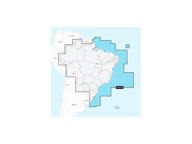
pNasa012R - Brazil - Navionics+ Get The World & Rsquo;S No. 1 Choice In Marine Mapping - With The Best, Most Up-To-Date Navionics+ Cartography On A Compatible Chartplotter. For Offshore Or Inland Waters, This All-In-One Solution Offers Detail-Rich Integrated Mapping Of Coastal Waters, Lakes, Rivers, And More. Get Sonarchart 1 & Rsquo; (0.5 Meters) Hd Bathymetry Maps And Advanced Features Such As Dock-To-Dock Route Guidance Technology, Live Mapping, And Plotter Sync To Provide Wireless Access To Daily Updates. The Navionics Chart Installer Software Also Ensures The Freshest Chart Data Every Time. Navionics Dock-To-Dock Route Guidance Solutions Suggest A Path To Follow Through Channels, Inlets, Marina Entrances, And More. Multiple Shading Options Aid In Shallow-Water Navigation And Make It Easy To Highlight A Target Depth Range For The Best Fishing Spots. Chart Code: Nasa012R Coverage Area: Detailed Coverage Of The Coast Of Brazil. Also Including The Amazon River From Benjamin Constant T
NAVIONICS NASA012R BRAZIL
Similar products

9 Band Radio With Bluetooth

Dual Compact LED Gaming Speakers

13.3" Portable Digital TV with 12V DC Car Adapter and Rechargeable Battery

Cubitt VIVA Pro Smartwatch / Fitness Tracker with 1.78" Touch AMOLED Screen

Drum Microphone Kit 9Pc All Metal Drummer Mics Tom/Snare & Cymbals Wired Instrument Drums Set
